Last-Mile Access Really Mean in Himalayan Villages extends far beyond basic road connectivity. It encompasses a complex interplay of seasonal isolation, steep terrain, high male outmigration, and vulnerability. True accessibility requires a multidimensional framework that links physical infrastructure with emergency medical response, climate resilience, and sustainable local livelihoods.
In the rugged terrain of Uttarakhand’s Kumaon region, the term “last-mile access” is frequently reduced to a single metric: kilometers of asphalt laid. However, for communities living in remote mountain settlements, the ground reality reveals that a road alone does not guarantee access. Last-mile access in the Central Himalayas is a socio-ecological lifeline. It is the determining factor between a community’s survival and its forced abandonment.
This policy analysis reframes last-mile access through an institutional lens, moving past conventional infrastructural definitions to analyze the structural bottlenecks of terrain, gendered demographics, and institutional gaps. By introducing the Himalayan Rural Access Pyramid, this article outlines actionable, low-maintenance strategies for grassroots organizations like Nauladhara Gram Vikas Samiti to build community-led resilience, leverage state convergence, and establish self-sustaining operational models that protect vulnerable mountain populations.
Background and Context: The Geography of Isolation
The Central Himalayan region, particularly the border district of Pithoragarh in Uttarakhand, presents a unique developmental paradox. While strategic border infrastructure and national highways have expanded rapidly, interior valley-to-ridge settlements remain functionally isolated. The topography is characterized by steep gradients, fragile shale formations, and extreme verticality where vertical ascents of several hundred meters separate a village from the nearest motorized road.
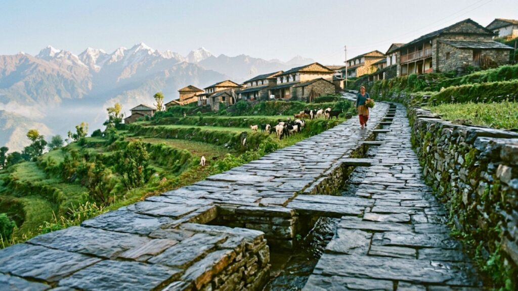
Historically, these mountain settlements relied on traditional, community-maintained pathways (pagdandis). These trails matched the ecological rhythm of the hills. However, shifting weather patterns, intense monsoon downpours, and a declining local workforce have degraded this micro-infrastructure. Last-mile access here is not an urban logistics challenge; it is a daily negotiation with terrain, weather, and physical isolation.
Current Situation in Uttarakhand: The Policy and Field Paradox
The Paradox of Infrastructure Without Access
According to data from the Ministry of Rural Development and the Pradhan Mantri Gram Sadak Yojana (PMGSY), thousands of kilometers of rural link roads have been carved into Uttarakhand’s hills over the last two decades. Yet, the state experiences some of the highest rates of village depopulation (bhootiyah gaon or ghost villages) in the country.
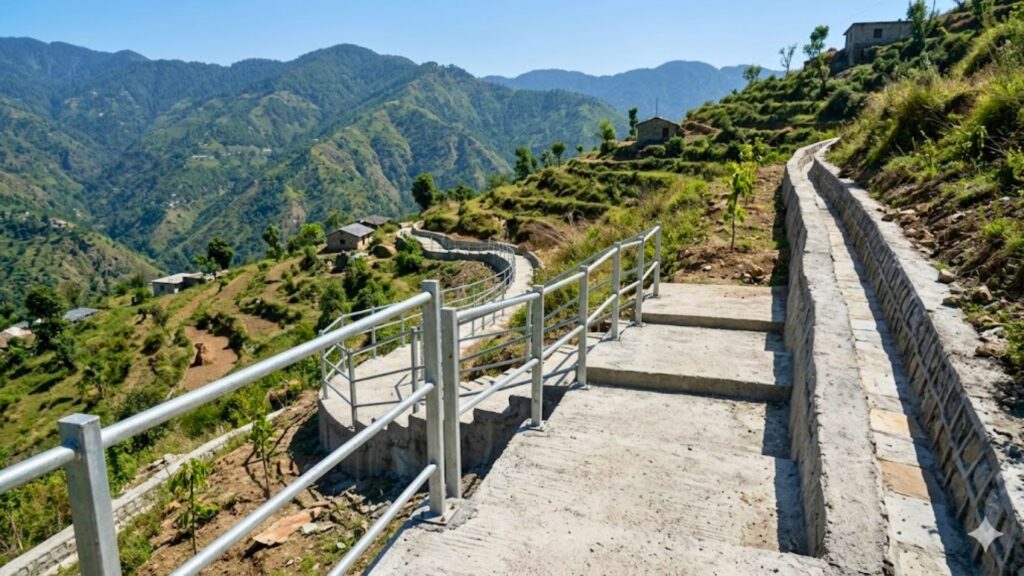
The policy gap lies in treating the terminus of a rural motor road as the end of the planning lifecycle. When a PMGSY road stops at a valley floor or a designated clearing, an isolated settlement situated 400 vertical meters above it remains practically unserved. The physical effort, time, and risk required to bridge the distance between the roadhead and the household doorstep constitute the unaddressed frontier of Himalayan rural planning.
Key Challenges and Root Causes
Last-mile access in mountain terrains is restricted by a combination of geological instability, fragmented administrative ownership, and severe structural maintenance deficits. These factors transform critical pedestrian pathways into hazardous, unusable trails during monsoon and winter seasons.
                     ┌───────────────────────────┐
                     │ Last-Mile Access Deficit  │
                     └─────────────┬─────────────┘
                                   │
         ┌─────────────────────────┼─────────────────────────┐
         ▼                         ▼                         ▼
┌─────────────────┐       ┌─────────────────┐       ┌─────────────────┐
│   Geological    │       │ Administrative  │       │ Structural/Eco  │
│  Instability    │       │  Fragmentation  │       │   Maintenance   │
└─────────────────┘       └─────────────────┘       └─────────────────┘
1. High-Gradient Topography and Geological Instability
Mountain slopes in the Kumaon Himalayas are geologically young and highly susceptible to shear stress. Standard civil engineering templates applied to rural road construction often trigger localized landslides, destabilizing the pedestrian trails located above or below the cut zone.
2. Administrative Fragmentation
Pedestrian pathways, suspension bridges, and village steps fall into an administrative grey zone. While the Public Works Department (PWD) or PMGSY handles vehicular roads, internal pathways are distributed across Gram Panchayats, the Revenue Department, or the Forest Department. This fragmentation leaves micro-infrastructure without dedicated budgets or systematic maintenance protocols.
3. The Structural Maintenance Deficit
The climate crisis has compressed monsoon precipitation into short, intense cloudburst events. These events wash away dry-stone retaining walls and concrete steps. Without dedicated village-level maintenance teams, small breaches quickly turn into major trail collapses, cutting off entire communities for weeks during seasonal monsoons.
Data and Evidence: The Human Cost of Isolation
A granular analysis of remote mountain habitations reveals a direct correlation between the quality of last-mile infrastructure and key socio-economic indicators:
| Access Indicator | Near-Road Habitations (<500m) | Remote Ridge Settlements (>2km from road) |
| Primary School Attendance (Monsoon) | 92% | 46% (Due to trail hazards and wildlife risks) |
| Delayed Institutional Medical Care | <1 Hour | 4 to 8 Hours (Requires manual stretcher carry) |
| Arable Land Abandonment Rate | 20-30% | 65-80% (High cost of manual head-loading) |
| Average Cost of Transporting Goods | ₹10–15 / Quintal | ₹150–300 / Quintal (Via manual labor/mules) |
Note: Data synthesized from regional rural planning reports and field observations in Pithoragarh district.
Impact on Vulnerable Populations
Impact on Women
   ┌────────────────────────────────────────────────────────┐
   │ Male Outmigration (Gurgaon, Delhi, Plain Areas)        │
   └───────────────────────────┬────────────────────────────┘
                               │ Leaves
                               ▼
   ┌────────────────────────────────────────────────────────┐
   │ Women-Led Rural Households (The "Double Burden")       │
   └───────────────────────────┬────────────────────────────┘
                               │ Combined with
                               ▼
   ┌────────────────────────────────────────────────────────┐
   │ Deficient Last-Mile Infrastructure                     │
   └───────────────────────────┬────────────────────────────┘
                               │ Triggers
                               ▼
   ┌────────────────────────────────────────────────────────┐
   │ Drastic increases in daily head-loading hours          │
   │ Severe physical/orthopedic strain                       │
   │ Heightened vulnerability to wildlife encounters        │
   └────────────────────────────────────────────────────────┘
In villages shaped by high male outmigration to urban centers like Delhi or Gurgaon, women serve as the primary farmers, caretakers, and heads of household. Deficient last-mile infrastructure places a double burden on them.
The absence of clean water systems near homes forces women to walk down steep, slippery gorges to fetch water from traditional springs (naulas or dharas). Similarly, fodder collection requires navigating degraded forest pathways, increasing their vulnerability to human-wildlife conflicts with leopards and wild boars.
Impact on Children
For children in settlements like Khitoli, the walk to school is a daily safety hazard. Dilapidated pathways, broken steps, and unfenced trails passing through dense undergrowth present ongoing physical risks. During the monsoon, swollen seasonal streams (gadhēras) without footbridges turn a routine commute into an impassable barrier, leading to high school absenteeism and lowered learning outcomes.
Impact on the Elderly Population
The elderly are often left behind in depopulated villages without immediate family support. When last-mile access degrades, they face severe social isolation and a complete loss of mobility. A broken path means an elderly resident cannot walk to the local post office or bank to collect their pension, nor can they access routine healthcare services. In emergencies, the lack of an even walkway prevents standard emergency stretchers from navigating the terrain safely.
Policy and Governance Perspective: The Convergence Gap
Current rural development programs like MGNREGA frequently prioritize short-term asset creation over long-term durability. This focus leaves mountain infrastructure vulnerable to rapid environmental degradation. Closing this gap requires shifting policy frameworks toward climate-resilient engineering standards.
National schemes like MGNREGA (Mahatma Gandhi National Rural Employment Guarantee Act) allocate substantial mandates for rural connectivity. However, the policy frame contains a critical gap: a preference for volume over resilience.
Gram Panchayats are incentivized to build new pathways using standard earth-cutting methods, but they rarely receive budgets to install essential protective structures like breast walls, toe walls, or proper drainage channels. As a result, newly constructed pathways often wash away during the next heavy rainfall.
Furthermore, state line departments rarely coordinate their work. For instance, the Jal Shakti Mission may lay water pipelines along a walking trail, but the trenching work often leaves the pedestrian pathway damaged and hazardous for users.
The Nauladhara Perspective: Redefining Accessibility
At Nauladhara Gram Vikas Samiti, we argue that last-mile access is not merely an engineering challenge; it is the foundation of community resilience and dignity. True access exists only when a vulnerable individual—such as a pregnant woman, an elderly citizen, or a young child—can safely navigate their village terrain under any weather conditions.
Our strategy avoids staff-heavy, high-expenditure models. Instead, we treat the pilot village of Khitoli as a living demonstration model. By focusing on low-maintenance, high-leverage field interventions, Nauladhara aims to design replicable solutions tailored to the ecological realities of the Kumaon hills.
The Original Framework: The Himalayan Rural Access Pyramid
To guide systematic field interventions and donor investments, Nauladhara has developed the Himalayan Rural Access Pyramid. This model establishes that sustainable hill development cannot occur until baseline physical security and structural access are secured.
                 / \
                /   \     Level 4: Economic Integration & Reverse Migration
               /     \    (Market links, cash crops, heritage eco-tourism)
              /───────\
             /         \  Level 3: Resource & Digital Inclusion
            /           \ (Pipeline water security, telemedicine, digital links)
           /─────────────\
          /               \ Level 2: Life Safety & Emergency Response
         /                 \ (Wildlife barriers, emergency stretcher tracks)
        /───────────────────\
       /                     \ Level 1: Core Structural Pedestrian Access
      /                       \ (Climate-resilient steps, drainage, retaining walls)
     /─────────────────────────\
Level 1: Core Structural Pedestrian Access
- Focus: Stabilizing existing walking trails between the roadhead and village clusters.
- Intervention: Building stone-paved steps with integrated side-drainage and dry-stone retaining walls to prevent erosion.
Level 2: Life Safety & Emergency Response
- Focus: Eliminating life-threatening environmental risks.
- Intervention: Installing solar streetlights along high-risk wildlife corridors, clearing blind corners on mountain bends, and implementing standard operating procedures for manual emergency transportation.
Level 3: Resource & Digital Inclusion
- Focus: Bringing essential services directly to households.
- Intervention: Reviving local natural springs (naulas) to secure water access, and setting up village-level digital kiosks to connect residents with telemedicine and administrative schemes.
Level 4: Economic Integration & Reverse Migration
- Focus: Monetizing stable village infrastructure.
- Intervention: Cultivating high-value aromatic plants on abandoned farmland, and converting vacant traditional houses into community-managed heritage spaces.
Practical Solutions for Remote Himalayan Villages
Grassroots interventions must prioritize low-maintenance, decentralized solutions. By combining traditional masonry techniques with modern solar and digital tools, remote communities can independently sustain their critical infrastructure.
To build an execution-focused roadmap for villages like Khitoli, we focus on five practical, low-maintenance interventions:
1. Climate-Resilient Pedestrian Pathways (Surakshit Marg)
- Execution: Abandon flat cement plastering, which cracks under winter frost and turns slick during monsoons. Use locally sourced, chiseled slate stone set into structural terraced steps.
- Design: Every flight of steps must feature an unlined stone side-drain (gool) to channel runoff away from the path’s foundation. This prevents water from undercutting the trail.
2. Community-Managed Emergency Transport Points
- Execution: Deploy lightweight, specialized mountain stretchers (wheel-assisted or impact-resistant rescue sleds) kept at a central location managed by a local women’s Self-Help Group (SHG) or the Mahila Mangal Dal.
- SOP: Train local youth and active field team members in emergency transfer protocols, ensuring a clear chain of communication between the village and the nearest roadhead transport link.
3. Solar Lighting for Wildlife Conflict Mitigation
- Execution: Install motion-activated solar streetlights at known wildlife crossing points and sharp trail bends.
- Management: Avoid high-maintenance central grids. Use independent, pole-mounted units with sealed lithium-ferro-phosphate (LiFePO4) batteries to minimize upkeep and ensure long-term functionality.
4. Decentralized Water Security via Spring Revival (Naula Conservation)
- Execution: Map and clean traditional freshwater springs. Construct simple recharge pits (khanti) along uphill slopes to increase groundwater infiltration and restore steady seasonal flow.
5. Digital Access Hubs (Gram Sampark)
- Execution: Set up a single computer terminal equipped with low-bandwidth satellite or cellular internet, managed by a trained local resident. This hub provides access to government portals, document downloads, and weekly telemedicine consultations, removing the need for residents to travel long distances for simple administrative tasks.
Case Examples from Himalayan Regions
The Tokoli Trail Stabilization
In a comparable high-altitude block within Pithoragarh district, a community-led initiative addressed a persistent landslide zone that regularly cut off a village cluster. Rather than waiting for heavy PWD machinery, the village council organized a local workforce to build a series of interlocking wooden and dry-stone check dams (bio-fencing) across the upper slope. They stabilized the soil by planting local deep-rooting grasses (Babiyo). This approach preserved the walking trail below and proved that micro-terrain management can outperform delayed institutional infrastructure responses.
Role of Community Institutions: Building Systems Over Personalities
For long-term sustainability, projects must not rely on the constant physical presence of a remote founder. Operations must be driven by institutional systems on the ground.
┌─────────────────────────────────┐
│     Nauladhara Board /          │
│     Remote Management           │
└────────────────┬────────────────┘
                 │ Strategic Oversight / Funding
                 ▼
┌─────────────────────────────────┐
│     Village Level Committee     │
│     (Mahila Mangal Dal / SHG)   │
└────────────────┬────────────────┘
                 │ Operational Execution
                 ▼
┌─────────────────────────────────┐
│     Local Field Workers /       │
│     Community Technicians       │
└─────────────────────────────────┘
- The Mahila Mangal Dal Framework: Entrust the daily monitoring of village pathways, water sources, and solar installations to local women-led institutions.
- The Maintenance Corpus: Establish a community-managed maintenance fund. A small fee collected from users of village services (like the digital access hub or product aggregation) funds immediate repairs for pathways or water lines, preventing small issues from escalating into major infrastructural failures.
- Remote Tracking Systems: Use simple smartphone tools and WhatsApp-based reporting templates. Local field coordinators can upload weekly photos of infrastructure assets, allowing remote managers to audit quality and track progress from afar.
Future Outlook: Climate Change and the Frontier of Rural Infrastructure
As climate variability increases across the Hindu Kush-Himalayan region, the frequency of cloudbursts, unseasonal rain, and flash floods will rise. Traditional rural planning templates must evolve.
Future investments from Corporate Social Responsibility (CSR) funds, international foundations, and government channels must shift their focus. Funding should pivot from building new roads to strengthening the resilience of existing decentralized infrastructure.
The survival of Himalayan ridge communities depends on this transition. If the footpaths, springs, and digital networks linking these villages to the wider world fail, the depopulation of the hills will accelerate, compromising both regional ecology and border-zone security.
You may also want to read this: Operations Launch: Nauladhara Central Office Established
Conclusion
Last-mile access in the Himalayan context is the foundation of effective rural development. A road terminus is simply a starting point; the true challenge lies in the pathways, springs, and safety networks that connect a village household to essential services.
By implementing practical, low-maintenance frameworks like the Himalayan Rural Access Pyramid, organizations can build resilient community networks. For Nauladhara Gram Vikas Samiti, the pilot in Khitoli village offers an opportunity to create a scalable, documented model for sustainable hill development across Uttarakhand—one step, one spring, and one village at a time.